• Residential
  • Commericial
  • Consulting
  • Previous
  • Blog
    • The Firm
    • Contact
    • Find
Menu

BWA

  • Residential
  • Commericial
  • Consulting
  • Previous
  • Blog
  • About
    • The Firm
    • Contact
    • Find
Watercolor map from Stamen available through tile-based image delivery in Heron.

Watercolor map from Stamen available through tile-based image delivery in Heron.

Slippy Maps in Heron

April 20, 2018

In the current version of Heron, you are able to import satellite imagery from Arcgis servers via the RESTRaster component.  The component will request an image of the REST service based on the bounding box of the curve(s) and download it to the specified folder.  This can be useful when assembling a high resolution texture map for a site model or site plan (tutorial here), however not all sources use this type of server to deliver their satellite images.  In fact, some of the most popular sources, such as Google and Mapbox, use tile-based delivery methods where a series of smaller image tiles are delivered based on the screen's bounding box (sometimes called a "slippy map").  Now, tile-based image delivery is geared for mobile and web-based applications where the app might request a few tiles at a time based on the "zoom level", however I thought it would be useful to add these types of sources to the next release of Heron, so I'm developing a component that would provide this.

The net effect between Heron's RESTRaster and the slippy raster component when looking to get high resolution images over a large area is that with RESTRaster you would divide up your boundary into smaller tiles before requesting the imagery and with slippy raster, you specify the zoom level as an integer and the tiling is taken care of.  Also the tile-based image sources generally provide higher resolution (pixels/sf) imagery.

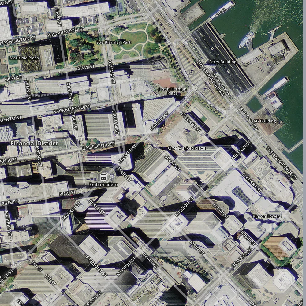
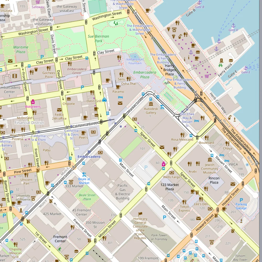
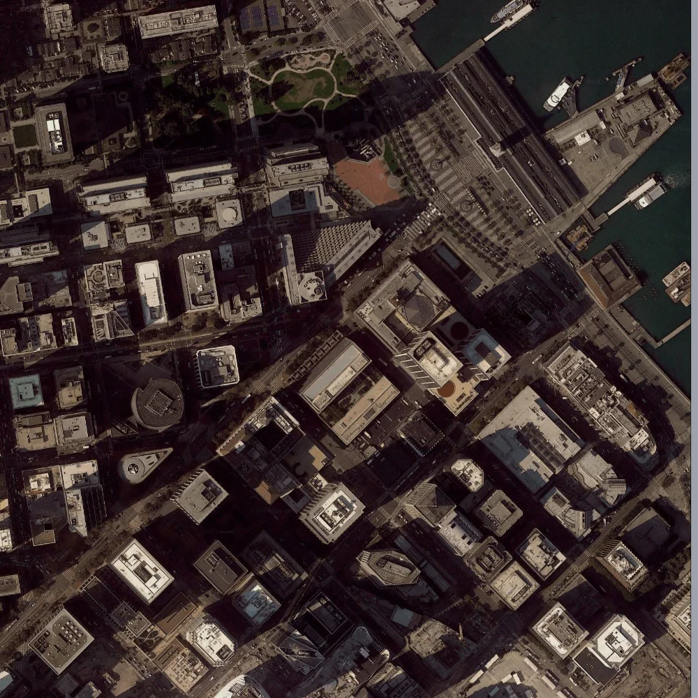
Below are some example screenshots of raster map sources from Mapbox, Google, OSM and Stamen which can be imported with the slippy raster component.  

View fullsize Mapbox - Satellite
Mapbox - Satellite
View fullsize Mapbox - Streets & Satellite
Mapbox - Streets & Satellite
View fullsize Mapbox - Comic
Mapbox - Comic
View fullsize Mapbox - Dark
Mapbox - Dark
View fullsize Mapbox - Emerald
Mapbox - Emerald
View fullsize Mapbox - High Contrast
Mapbox - High Contrast
View fullsize Mapbox - Light
Mapbox - Light
View fullsize Mapbox - Outdoors
Mapbox - Outdoors
View fullsize Mapbox - Pencil
Mapbox - Pencil
View fullsize Mapbox - Pirates
Mapbox - Pirates
View fullsize Mapbox - Run, Bike & Hike
Mapbox - Run, Bike & Hike
View fullsize Mapbox - Streets
Mapbox - Streets
View fullsize Mapbox - Streets Basic
Mapbox - Streets Basic
View fullsize Open Street Map - Basemap
Open Street Map - Basemap
View fullsize Open Street Map - Black & White
Open Street Map - Black & White
View fullsize Open Street Map - No Labels
Open Street Map - No Labels
View fullsize Stamen - Toner
Stamen - Toner
View fullsize Stamen - Watercolor
Stamen - Watercolor
View fullsize Stamen - Terrain
Stamen - Terrain
View fullsize Open Street Map - Humanitarian
Open Street Map - Humanitarian
View fullsize Google - Hybrid
Google - Hybrid
View fullsize Google - Road Map
Google - Road Map
View fullsize Google - Satellite
Google - Satellite
View fullsize Google - Terrain
Google - Terrain

And here's an example of how the zoom level affects the resolution of the map given the same boundary.  With an exponential relationship, the higher the zoom level, the more tiles make up the image.  The slippy raster component takes care of stitching the tiles together into one image.

View fullsize Zoom = 10 Tiles = 1
Zoom = 10 Tiles = 1
View fullsize Zoom = 11 Tiles = 1
Zoom = 11 Tiles = 1
View fullsize Zoom = 12 Tiles = 1
Zoom = 12 Tiles = 1
View fullsize Zoom = 13 Tiles = 1
Zoom = 13 Tiles = 1
View fullsize Zoom = 14 Tiles = 1
Zoom = 14 Tiles = 1
View fullsize Zoom = 15 Tiles = 4
Zoom = 15 Tiles = 4
View fullsize Zoom = 16 Tiles = 9
Zoom = 16 Tiles = 9
View fullsize Zoom = 17 Tiles = 20
Zoom = 17 Tiles = 20
View fullsize Zoom = 18 Tiles = 64
Zoom = 18 Tiles = 64
View fullsize Zoom = 19 Tiles = 210
Zoom = 19 Tiles = 210
In Grasshopper, Heron Tags RESTRaster, Slippy, WIP
← Mesh PatchGoogle Street View in Heron →

About

This blog primarily exhibits how-to and work-in-progress posts related to Heron, a Grasshopper add-in which BWA developed to import GIS data into the Rhino 3d modeling environment.

Support Heron on Patreon

Latest Posts

Featured
Multi-Boolean
Jun 6, 2018
Multi-Boolean
Jun 6, 2018

Making quick work of custom perforating hundreds of panels by multi-threading boolean difference operations in Grasshopper.

Jun 6, 2018
Mesh Patch
Jun 5, 2018
Mesh Patch
Jun 5, 2018

Have building outlines with courtyards?  Looking for a quick way to turn these into building masses?  The new Mesh Patch command in Rhino 6 can help.

Jun 5, 2018
Slippy Maps in Heron
Apr 20, 2018
Slippy Maps in Heron
Apr 20, 2018

Enabling tile-based image delivery for Heron (WIP)

Apr 20, 2018
Google Street View in Heron
Apr 2, 2018
Google Street View in Heron
Apr 2, 2018

Providing more touch points from the real world in Heron (WIP).

Apr 2, 2018

Archive

© Brian Washburn Architect PC